CGIS Solutions provides cost-effective solutions to engage your citizens, mobilize your workforce, cut down on counter traffice, and provide key decision-makers the tools they need to manage local government. Our applications support many government functions including land management, public safety, public works, elections, and utilities.
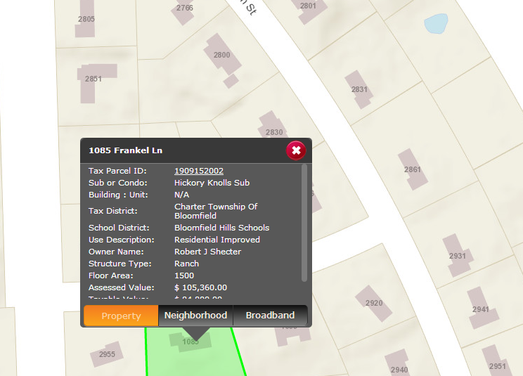
Provide public access to tax parcel and assessment data with links to download related records on desktop and mobile devices.
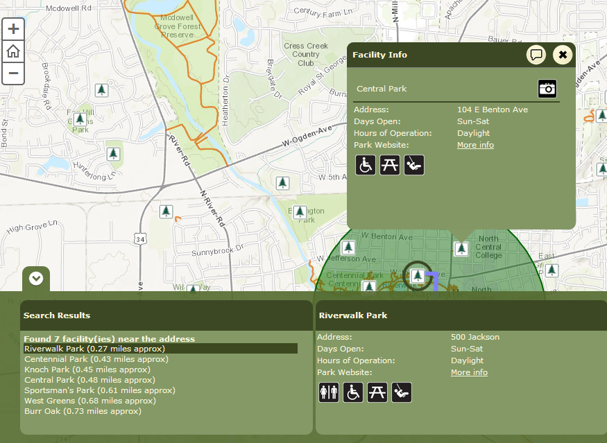
Allow citizens to locate and obtain information about a park or recreation facility in their community.
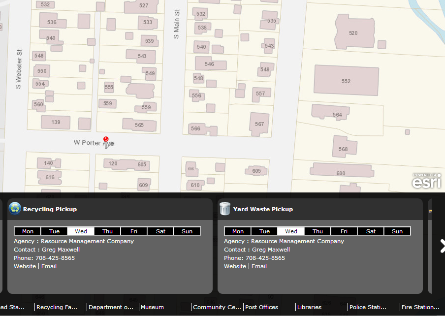
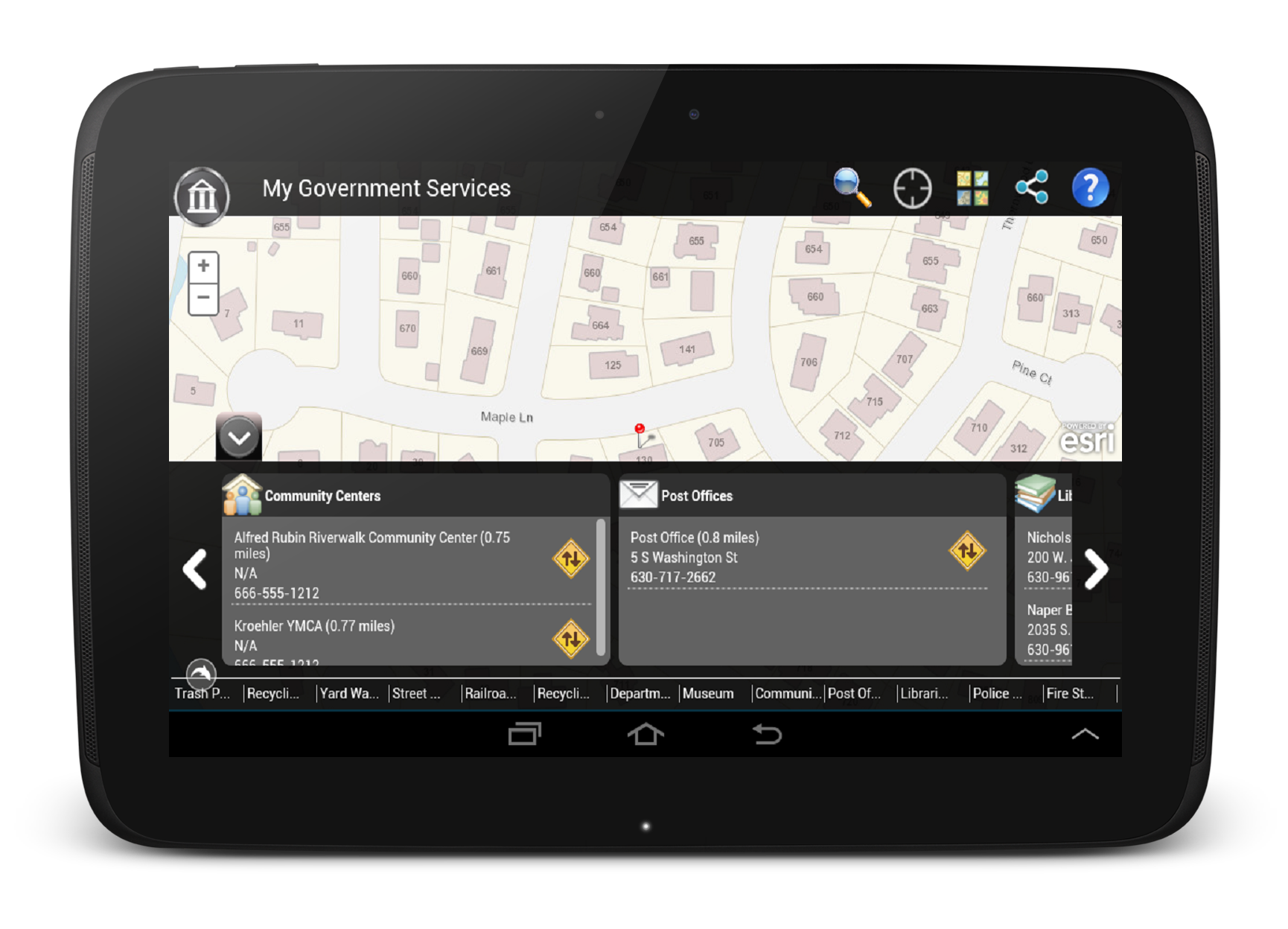
Help citizens locate various government facilities, as well as access information and schedules of curbside and drop-off services.
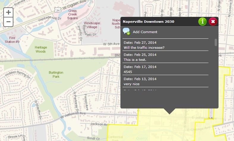
Allow the public and other interested parties to comment on land-use changes being proposed in their local government.
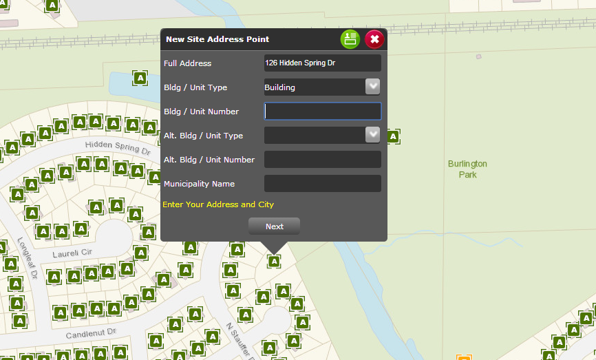
Manage address information and allow the public to contribute missing site address locations and contact information.
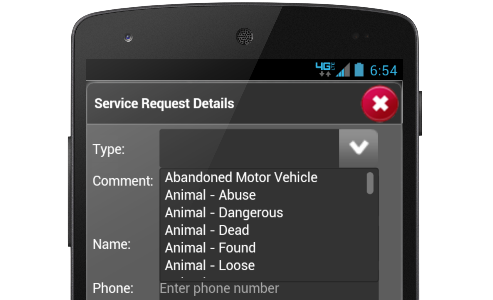
Allow the general public to submit requests for service at the service site, with options to upload pictures from their desktop, tablet, or cell phone.
We provide a host of additional "ready-to-deploy" solutions like the examples above. We also provide custom application development and system integrations including Esri’s Local Government Information Model (LGIM) and ArcGIS Online solutions to meet local government needs.
Contact CGIS Solutions to see a demonstration or talk about how to get started!